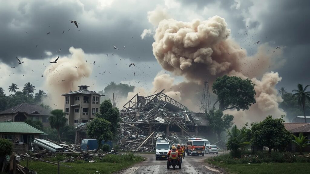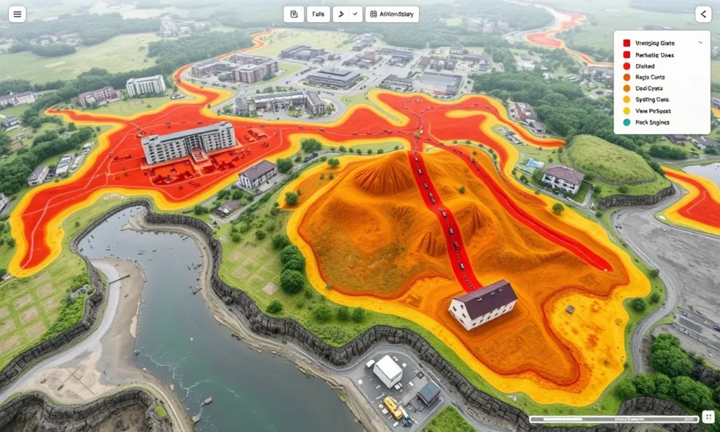
Disaster management has always been about quick, informed decision-making. But with AI-powered Geographic Information Systems (GIS), the game has changed. Combining real-time data with predictive analytics, AI GIS is reshaping how we prepare for, respond to, and recover from disasters.
Understanding AI GIS: The New Frontier in Crisis Response
What Is AI GIS and How Does It Work?
AI GIS integrates artificial intelligence with geospatial data to analyze, predict, and respond to events. It processes satellite images, real-time social media feeds, and historical data to create actionable insights. Imagine a system that predicts flooding zones days before a storm hits!
At its core, AI GIS uses machine learning algorithms to:
- Identify patterns in historical disaster data.
- Forecast risk areas based on weather trends.
- Provide live updates on evolving situations, such as wildfires or hurricanes.
Why Traditional GIS Systems Fall Short
Conventional GIS relies on static maps and manual analysis, making it slow during fast-changing disasters. AI GIS, on the other hand, is dynamic. It updates in real-time and automates insights. This capability is crucial when every second counts in saving lives.
AI GIS Tools at Work Today
Some notable platforms include:
- Google’s AI Flood Forecasting System, predicting floods before they happen.
- NASA’s Disaster Program, monitoring and mitigating global hazards.
Each combines AI-driven analysis with geospatial data, ensuring communities stay ahead of potential threats.
Real-Time Disaster Tracking: A Lifeline for First Responders
How Real-Time Data Saves Lives
Imagine tracking a wildfire’s movement as it happens. Real-time AI GIS systems provide such capabilities, helping responders evacuate vulnerable areas swiftly. They collect live data from satellites, drones, and IoT sensors, making it easy to visualize risks.
For example, during Hurricane Ida, AI GIS tools tracked flooding zones, guiding rescue teams to stranded survivors. This kind of precision and speed wouldn’t be possible without AI-driven systems.
Integrating IoT and Drones for a Comprehensive Picture
IoT sensors and drones are game-changers in disaster tracking. IoT devices monitor environmental changes like temperature spikes or water levels, while drones provide aerial perspectives of hard-to-reach areas. Together, they create a rich dataset for AI GIS to analyze in real time.
Examples of Life-Saving Applications
- Evacuation route optimization: AI GIS suggests the safest, quickest paths out of disaster zones.
- Resource allocation: It directs medical supplies and personnel to where they’re needed most.
This ensures a coordinated response that saves time and, more importantly, lives.
Predictive Analytics: Stopping Disasters Before They Strike
Forecasting the Unpredictable
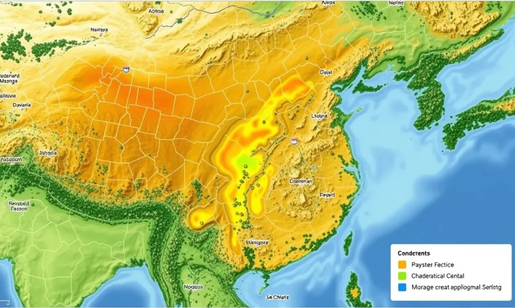
AI GIS doesn’t just react—it predicts. By analyzing weather data, seismic activity, and historical events, it identifies risks before they escalate. Early warnings empower governments to act decisively, minimizing the impact.
For instance, AI GIS systems predicted Cyclone Amphan’s trajectory with precision, enabling Indian authorities to evacuate millions ahead of time.
Risk Mapping and Vulnerability Assessments
AI GIS generates risk maps that show areas most likely to face natural hazards. This information helps city planners design resilient infrastructure and prioritize vulnerable communities.
Bridging Gaps in Global Preparedness
Developing countries often lack access to advanced tools. However, scalable AI GIS solutions are closing the gap, offering affordable, cloud-based platforms for risk management worldwide.
AI GIS in Post-Disaster Recovery
Damage Assessment Made Easy
After disasters strike, assessing damage is crucial but challenging. AI GIS simplifies this with satellite imagery and machine learning models. It automatically evaluates the extent of destruction, identifying areas that need immediate aid.
For example, after the 2020 Beirut explosion, AI GIS mapped the devastation within hours, guiding relief efforts effectively.
Coordinating Long-Term Recovery
Recovery isn’t just about immediate relief—it’s about rebuilding smarter. AI GIS aids governments in planning resilient infrastructure that can withstand future disasters. It also helps monitor recovery progress, ensuring that resources are used effectively.
Strengthening Community Resilience
By involving local communities in data collection and analysis, AI GIS fosters collaborative recovery efforts. Crowdsourced data from apps can complement official statistics, creating a fuller picture of the situation on the ground.
Every second counts in disasters—AI GIS ensures no second is wasted.
—Emergency Specialist
Ethical Considerations: Balancing Innovation and Privacy
The Data Privacy Debate
AI GIS relies on vast amounts of data, raising concerns about privacy. For instance, should real-time social media tracking for disaster response infringe on individual rights?
Ensuring data protection policies is vital for ethical implementation. Transparency about how data is used builds trust with affected communities.
Preventing Bias in Algorithms
AI systems can inadvertently prioritize wealthier regions over poorer ones. Developers must design algorithms that distribute resources equitably, especially in diverse populations.
The Role of Global Collaboration
Ethical challenges call for international cooperation. Establishing shared guidelines ensures that AI GIS systems are fair, inclusive, and universally beneficial.
AI GIS and Climate Change: Fighting a Growing Threat

Addressing Climate-Driven Disasters
Climate change is intensifying disasters like floods, hurricanes, and wildfires. AI GIS is stepping up to confront these challenges. By monitoring environmental changes, it predicts risks associated with rising sea levels, extreme temperatures, and prolonged droughts.
For example, AI GIS tools have been instrumental in identifying regions vulnerable to glacier melts, preventing unexpected floods in mountain communities.
Building Climate Resilience with AI GIS
Resilience is more than disaster response; it’s about preparedness. AI GIS helps cities and communities adapt to climate risks by:
- Designing flood-resistant urban infrastructure.
- Mapping heat islands to target cooling initiatives.
- Enhancing agricultural planning to withstand droughts or storms.
Supporting Global Climate Goals
AI GIS aligns with global initiatives like the Paris Agreement by offering tools for monitoring carbon emissions and deforestation. Governments use this tech to track progress and adjust strategies to meet sustainability targets.
Public-Private Partnerships: Driving Innovation in AI GIS
Tech Giants and Governments Collaborate
Tech companies like Google, Microsoft, and IBM are partnering with governments to create cutting-edge AI GIS systems. These collaborations leverage the private sector’s technical expertise and public funding to deploy solutions at scale.
For instance, Microsoft’s AI for Earth program offers cloud-based tools for disaster prediction and environmental conservation, making AI GIS accessible to underfunded regions.
NGOs and Grassroots Integration
Nonprofits and community organizations play a crucial role in AI GIS adoption. By training locals in data collection and system usage, they ensure solutions are grounded in community needs.
The Importance of Open-Source Platforms
Open-source AI GIS platforms encourage innovation by allowing global developers to contribute. This democratization of technology ensures that even low-resource areas can benefit from advanced disaster management systems.
Breaking Barriers: Challenges in Scaling AI GIS
Bridging the Tech Divide
While AI GIS has proven transformative, not all regions can access this technology. Rural and underserved areas often lack the infrastructure and funding needed to implement these systems. Addressing this gap is critical to ensuring global equity in disaster response.
Overcoming Technical Limitations
AI GIS systems are only as good as their data. Inconsistent or outdated datasets can lead to inaccurate predictions. Investing in robust, real-time data collection mechanisms is essential for reliable results.
Managing the Cost of Innovation
Developing and maintaining AI GIS technology requires significant investment. Governments and organizations must balance funding for immediate disaster relief with the long-term benefits of AI GIS systems.
The Future of AI GIS: Transforming Crisis Management
Advancing Predictive Capabilities
AI GIS is evolving rapidly. Future systems may integrate quantum computing, enabling unprecedented processing speeds and predictive accuracy. This could revolutionize how we anticipate disasters.
Personalizing Disaster Warnings
Soon, AI GIS could offer individualized alerts based on location, vulnerability, and personal data. Imagine receiving a tailored evacuation plan on your phone seconds after a warning is issued.
Pioneering Space-Based Monitoring
Space agencies are exploring satellite constellations for continuous Earth observation. Coupled with AI GIS, these satellites could provide real-time insights into global hazards, improving crisis response worldwide.
With its life-saving potential, AI GIS is transforming how humanity faces natural disasters. From tracking hurricanes in real-time to rebuilding after earthquakes, this technology ensures we’re smarter, faster, and better prepared for whatever comes our way.
FAQs
Can AI GIS help in preventing wildfires?
Yes, AI GIS plays a critical role in wildfire prevention. By monitoring dry conditions, wind patterns, and vegetation density, it identifies areas at high risk. Drones equipped with thermal imaging can pinpoint early fire outbreaks, and AI GIS maps their potential spread. In California, such systems have helped firefighters contain wildfires more efficiently.
What role does AI GIS play in post-disaster recovery?
Post-disaster, AI GIS assesses damage by analyzing satellite imagery and ground reports. It identifies affected areas and prioritizes relief efforts. For example, after the Haiti earthquake, AI GIS mapped destroyed buildings, guiding humanitarian organizations to allocate resources effectively.
Is AI GIS accessible in developing countries?
While AI GIS adoption is more common in developed regions, open-source platforms and international aid programs are expanding access. For example, the United Nations uses AI GIS tools to support disaster preparedness in African and Asian countries with limited resources. These efforts are bridging the technology gap.
How do drones and IoT devices enhance AI GIS?
Drones and IoT sensors provide real-time data crucial for AI GIS systems. Drones offer aerial perspectives, capturing images of inaccessible areas during disasters like floods or landslides. IoT devices monitor environmental factors like water levels or seismic activity, feeding continuous data into AI GIS for more accurate analysis.
What are the privacy concerns associated with AI GIS?
AI GIS systems rely on extensive data collection, including location tracking and social media analysis, which raises privacy issues. Ensuring strict data protection measures and anonymizing personal information are critical for ethical implementation. For example, during Hurricane Harvey, social media data was used to map flooding, but privacy concerns were addressed through aggregate, anonymous analysis.
Can AI GIS help combat climate change-related disasters?
Absolutely! AI GIS tracks climate trends, helping predict and prepare for disasters linked to global warming. For instance, it monitors rising sea levels to identify coastal areas at risk of flooding. In Bangladesh, AI GIS has been used to develop early warning systems for cyclones, reducing casualties significantly.
Are AI GIS systems expensive to deploy?
While AI GIS systems can be costly, affordable and scalable solutions are emerging. Cloud-based platforms reduce infrastructure costs, and open-source tools make these systems accessible. Organizations like OpenStreetMap and Esri offer free resources that governments and NGOs can leverage for disaster management.
How can communities benefit from AI GIS?
Communities can use AI GIS tools to stay informed and prepared. For instance, apps powered by AI GIS provide real-time evacuation routes or flood warnings. Local involvement in data collection—such as sharing geotagged photos of hazards—also enhances the system’s accuracy, ensuring tailored responses that address specific needs.
How is AI GIS used for flood management?
AI GIS plays a pivotal role in predicting and managing floods. By analyzing rainfall data, river flow patterns, and soil saturation levels, it can forecast potential flooding zones. During the 2022 Pakistan floods, AI GIS helped map high-risk areas and plan evacuation routes, minimizing loss of life and property.
Can AI GIS support disaster education and preparedness?
Yes, AI GIS is a powerful tool for disaster education. It visualizes risks through interactive maps, helping communities understand their vulnerabilities. For example, schools in Japan use AI GIS simulations to teach students about tsunami risks and evacuation procedures, fostering a culture of preparedness.
What industries can benefit from AI GIS in disaster scenarios?
Many industries benefit from AI GIS during disasters, including:
- Insurance companies, which use it to assess risks and process claims faster.
- Energy providers, which monitor power grids and predict outages.
- Logistics firms, which optimize supply chains during crises.
For example, during Hurricane Maria, logistics companies used AI GIS to identify the best routes for delivering relief supplies to Puerto Rico.
How does AI GIS handle misinformation during disasters?
Misinformation spreads quickly during crises, but AI GIS mitigates this by verifying real-time data from trusted sources. For instance, social media posts are cross-referenced with official updates, ensuring accurate insights. This approach was successfully used during the Australian bushfires, where verified maps guided relief efforts.
What’s the future of AI GIS in humanitarian efforts?
AI GIS is expected to play an even larger role in humanitarian work. Future advancements might include:
- Personalized disaster alerts based on user-specific risks.
- AI GIS-driven refugee camp planning to ensure efficient use of resources.
For example, during the Syrian refugee crisis, AI GIS was used to identify ideal locations for camps, considering factors like water availability and proximity to urban centers.
Can AI GIS predict pandemics or health emergencies?
AI GIS has been adapted to address health emergencies by mapping disease outbreaks and tracking their spread. During the COVID-19 pandemic, GIS systems visualized case trends, helping governments allocate medical resources. AI GIS can also predict mosquito-borne diseases like malaria by analyzing weather patterns and breeding hotspots.
What’s the environmental impact of using AI GIS?
AI GIS systems promote environmental sustainability by guiding disaster recovery in eco-friendly ways. For instance, after wildfires, they help plan reforestation efforts by identifying suitable areas for planting. In addition, AI GIS supports renewable energy projects by analyzing geographic data to find ideal locations for solar farms or wind turbines.
How can governments ensure equitable access to AI GIS?
To ensure equitable access, governments must invest in infrastructure and training. Partnering with tech firms and NGOs can help make AI GIS tools available in underserved regions. For example, the African Risk Capacity agency uses AI GIS to improve disaster resilience in low-income African nations, providing tools for drought monitoring and risk planning.
Is AI GIS effective for smaller-scale disasters?
Absolutely. While often associated with large-scale events, AI GIS is equally useful for localized disasters like urban flooding or building fires. Municipal governments in cities like Amsterdam use AI GIS to manage stormwater drainage, preventing neighborhood-level flooding after heavy rains.
How do cultural and linguistic factors affect AI GIS usage?
Cultural and linguistic differences can influence how communities engage with AI GIS tools. For instance, localized interfaces and multilingual alerts ensure effective communication. AI GIS apps in India, for example, support multiple regional languages to ensure inclusivity during disaster warnings.
Resources
Online Courses and Tutorials
- Esri Academy
Esri offers free and paid courses on GIS, including AI integrations. Their resources range from beginner-friendly GIS basics to advanced AI-powered mapping techniques.
Website: Esri Academy - Coursera: AI for Everyone by Andrew Ng
While not GIS-specific, this course provides an excellent foundation in AI concepts that can be applied to GIS technologies.
Website: Coursera AI for Everyone - NASA ARSET Training
NASA provides free training programs on remote sensing and GIS, focusing on disaster management applications.
Website: NASA ARSET
Open-Source Tools and Platforms
- QGIS
A free and open-source GIS platform that supports AI integrations. It’s widely used for spatial data analysis and disaster response planning.
Website: QGIS - Google Earth Engine
Google’s powerful platform for analyzing geospatial data, with AI-driven capabilities for disaster prediction and recovery.
Website: Google Earth Engine - OpenStreetMap
A crowdsourced platform providing free geographic data, often used in disaster mapping and humanitarian efforts.
Website: OpenStreetMap
Research Papers and Case Studies
- UN Office for Disaster Risk Reduction (UNDRR)
Access research and case studies on disaster management strategies, including AI GIS implementations.
Website: UNDRR Resources - International Federation of Red Cross and Red Crescent Societies (IFRC)
The IFRC shares reports on using GIS tools in humanitarian crises and disaster recovery.
Website: IFRC Resources - Nature Journal
Articles on AI GIS applications in climate change and disaster management often appear in Nature’s Earth and Environmental Sciences section.
Website: Nature – Environment
Government and NGO Resources
- FEMA (Federal Emergency Management Agency)
FEMA provides guides on using GIS in disaster response and recovery, along with free tools and datasets.
Website: FEMA GIS Resources - The World Bank: GFDRR (Global Facility for Disaster Reduction and Recovery)
This initiative offers resources and data to help countries implement AI GIS for disaster risk management.
Website: GFDRR - ReliefWeb
A humanitarian information service providing GIS maps and disaster-related data for governments and NGOs.
Website: ReliefWeb
Books and Publications
- “Introduction to GIS for Disaster Management” by Esri Press
A comprehensive guide to GIS applications in disaster management, including real-world case studies.
Available on: Esri Press Store - “The Big Data-Driven World of Disaster Response” by Jay Marathe
Explores how big data and AI GIS are revolutionizing disaster response.
Available on: Amazon - “Remote Sensing for Natural Disasters” by Shunying Ji
A deep dive into using satellite data and GIS for disaster monitoring and mitigation.
Available on: Springer
Communities and Forums
- GIS Stack Exchange
A community-driven forum for discussing GIS challenges, including AI applications.
Website: GIS Stack Exchange - LinkedIn Groups
Join groups like “GIS and Remote Sensing Professionals” or “AI for Climate Action” to network and share insights.
Website: LinkedIn Groups - Humanitarian OpenStreetMap Team (HOT)
Collaborate with global volunteers to map disaster-prone areas and support AI GIS initiatives.
Website: HOTOSM
